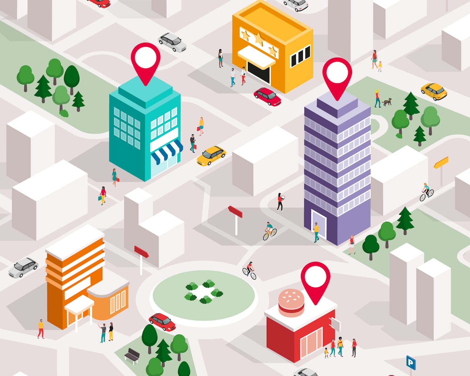
Geographic information system (GIS) has been around for a long time, dating back to the 1960’s or earlier by many accounts, it has helped urban and regional planners better understand their environment with data rich mapping. In recent decades, GIS has become an important business tool, helping companies understand patterns, trends, and relationships by using socio-demographic, economic, and many other forms of data in the context of location through advanced urban mapping software. Now GIS is beginning to take advantage of the sensory development inside smart buildings to bring its powerful mapping to our indoor environments.
“While GIS has long been limited to the outdoor world, new technology has now also paved the way for indoor GIS. Activating the power of location inside buildings provides occupants with unprecedented levels of visibility and actionable data. Indoor GIS helps increase workflow efficiencies and productivity and enables smart buildings,” reads an official statement from a GIS market leader, ESRI. “As GIS professionals are constantly seeking to collect and analyze spatial data to derive meaningful insights, and extending the range of their work to the indoor space opens entirely new opportunities.”
Just as the technology worked outdoors, GIS can help businesses understand patterns, trends, and relationships inside their buildings for a wide range of benefits. Like with urban and neighborhood maps, indoor GIS can trace the movement of people and the occupancy habits to enhance the human experiences and optimize business operations. By combining with advanced design technologies like building information modelling (BIM) and the sensory capabilities of the Internet of Things (IoT), indoor GIS can facilitate better space utilization, traffic flows, collaboration, productivity, even health and safety during the pandemic.
“In light of the COVID-19 pandemic, GIS can be leveraged to support business continuity and reduce the risk of infections at the workplace as employers are gradually reopening their facilities. Location data provides employers with the information they need to create a safe indoor environment in preparation for the return of their employees,” ESRI continues. “Analyzing how employees move inside the facility and identifying potential risks (e.g., narrow corridors) help management take proactive measures. By visualizing this data on the workplace map, it is easy to determine danger zones and learn how to avoid or mitigate potentially hazardous situations.”
On the most basic level, indoor GIS can map out the workplace to support social distancing by ensuring desks and chairs are appropriately arranged or that the space is being utilized safely and optimally. Going deeper, GIS can introduce the movement of people to its data-rich maps, allowing bottlenecks and dwell zones to be identified, then solutions can be developed. Advanced indoor GIS implementation can go further by adding credentials to occupants on these maps, including security clearance and even infection risk. From there, geofencing can be used to create virtual zones on the map and highlight when unauthorized or at risk people enter undesirable spaces.
“Our industry is intimately tied to the safe delivery and operation of the infrastructure of our daily lives that most people take for granted — water utilities, electrical utilities, telecom organizations, local governments, state and federal government organizations have all had to continue operating [during the pandemic] for the good of the general population,” says Gareth Gibson, Marketing Director, Mapping & GIS Solutions at Trimble. “And while it has been challenging for our customers to continue their work in very restricted conditions, the collection, capture and maintenance of spatial data, as well as asset inspection and maintenance, in these industries has actually continued.”
While the novel needs of buildings during COVID-19 has become a driver for indoor GIS implementation, the technology can provide benefits far beyond the pandemic. Combining with the IoT and BIM data, indoor GIS mapping can improve space and resource utilization in general, for greater efficiency, occupant comfort, and worker productivity. Detailed GIS data can be used to automate room booking, monitor workflow, and make informed decisions about how, when, and why various spaces are used, for example. The technology’s highly visual data experience provides more actionable intelligence for employers and buildings managers.
GIS can also support security and emergency planning in buildings. By adding all cameras and security devices to a 3D GIS map, facility managers can ensure optimum security coverage and better allocate security resources across the building. In the case of an emergency, GIS maps can provide the real-time information employees need to move quickly and stay safe. When the fire alarm is triggered, for example, the mapping system can automatically send an emergency notification to employees that shows the best way to an indoor or outdoor protected area. Tracking the movement of people during an emergency or a drill also allows building managers to resolve bottlenecks and better place emergency resources.
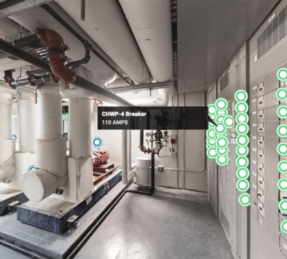
GIS mapping allows facility managers to add detailed information to their smart building assets, including everything from chairs and desks, to heavy office equipment and HVAC systems. With this information, facility managers can keep track of maintenance schedules, numerous equipment requests, and ever-changing worker schedules. Companies can also set up alerts that display a notification on the map when something requires maintenance, and send an automatic notification to the appropriate personnel. In doing so, GIS provides building managers new ways to automate alerts and ensure maintenance teams have all the information they need.
“It’s not about the open data, it’s about connecting tools to tools at the data level so that, bang! It just changes things,” ESRI CEO, Jack Dangermond, said during a media Q&A at Autodesk University last year. “There’s a GIS view of the world and there’s the whole engineering, construction, design, build view of the world. The GIS view, for those who don’t know it, is that we measure things and we visualize things. Then we do analytics and we support design tools, and then people take it to action.”
The GIS view of the building is familiar, offering occupancy tracking and space utilization benefits, but with a new level of visual data interpretation based on the technology’s advanced use of mapping. These maps don’t just chart locations, they unlock and formulate meaning in the context of location, they form bridges between people and spaces that were not previously connected, and they visiualize the indoor environment in a way that allows powerful new ideas to emerge. GIS technology has been the cornerstone to planning and design in the outdoor world, and by bringing the technology indoors we can enable a new smarter era for the design and planning of our buildings.